GROUND PENETRATING RADAR
What is Ground Penetrating Radar (GPR)?
Ground Penetrating Radar (GPR) is a non-destructive field survey method that creates a cross-sectional image of the subsurface.
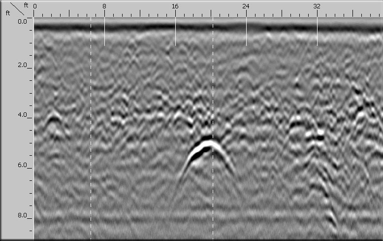
A GPR system radiates short pulses of high frequency radio signal into the ground from a transmitting antenna. The radio signals travels into the ground at a velocity that is related to the electrical properties of the subsurface materials, or, the materials dielectric permittivity. When the radio signals interface with two materials having different dielectric properties (utility and surrounding soils or surrounding concrete), a portion of the energy is reflected back to the transmitting antenna on the surface. The control unit on the GPR system measures the amount of time it takes for the radio signal to travel to and from the target which indicates its depth and location. The reflected data is displayed on the control unit in real time where it can be interpreted by the operator. The collected GPR data is used to verify presence of utilities, buried objects, or items embedded concrete slabs or structures.

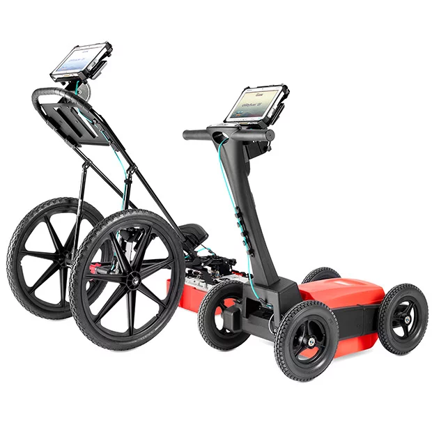
Our technicians are equipped with StructureScan Pro, MiniXT, and UtilityScan Pro GPR systems, along with an array of GPR antennas to handle the demands of any subsurface locate scenario. These GPR systems are manufactured by Geophysical Survey Systems, Inc. of Nashua, NH and are widely recognized as the industry standard for ground penetrating radar surveying.
Analysis of GPR data

Different types of soil, concrete, levels of saturation and different layers of overburden between the GPR unit and the target objects all have different dielectric properties which change the profile that is seen by the operator.
GPR data that is collected on site can vary greatly due to these factors, and needs to be interpreted by qualified technicians trained to accurately identify findings.


Depth of Penetration

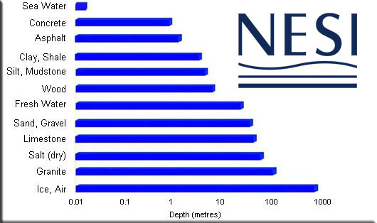
Ground penetrating radar depth of penetration is a function of antenna frequency and the electrical conductivity of the soils or concrete at each survey area. For utility locating we typically use a 400MHz antenna, and for concrete imaging surveys we use 1600 – 2700MHz antennas.
With the following parameters in mind, average depth penetration would be:
- 400MHz antenna in clean dry sand – approximately 8-10′
- 400MHz antenna in dense wet clay – approximately 3-6′
- 1600MHz antenna in a cured concrete slab – approximately 12-18″
- 1600MHz antenna in an uncured concrete slab – approximately 3-6″
Concrete Imaging (GPR)

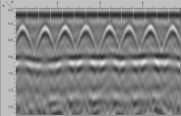
Concrete scanning can be done in both 2 dimensional and 3 dimensional methods. 2 dimensional concrete inspection consists of performing basic line scans in a north south, east west direction over the survey site. 3 dimensional concrete imaging is done using a grid paper, laying down evenly spaced scans that are organized line by line. The data is processed by the control unit and creates a 3D plot that can be viewed slice by slice, much like an MRI scan.
Performing an accurate concrete imaging survey is a delicate process and requires experienced ground penetrating radar (GPR) technicians, and proper system deployment prior to the survey being performed.

The following must be performed at each concrete imaging site to ensure targets are not missed, and depth to surveyed targets is accurate.
- Survey wheel calibration – Survey wheel must be calibrated to a known linear distance prior to performing any scans
- Profile scans – Profile scans must be performed surrounding the survey area to determine slab contents and target direction
- Dielectric assessment – The slab or concrete structure’s dielectric value must be determined before beginning to collect data
- Concrete scanning – Scanning is performed after proper system deployment. Either 2 dimensional or 3 dimensional scans are performed on site and results are interpreted by the operator.
- Slab or structure mark out – Survey results are interpreted and targets are identified and marked on the slab surface.
Using these survey methods we are able to locate rebar and mesh reinforcement, conduit, pipes, post tension cables, structural items, determine slab thickness and scan for potential voids.
Concrete Imaging & GPR Services
To schedule a concrete imaging survey, or to learn more about how our GPR services can assist on your project, give us call or send us an email. We currently serve CT, NY, MA and RI.
Call Us
Send Mail
